
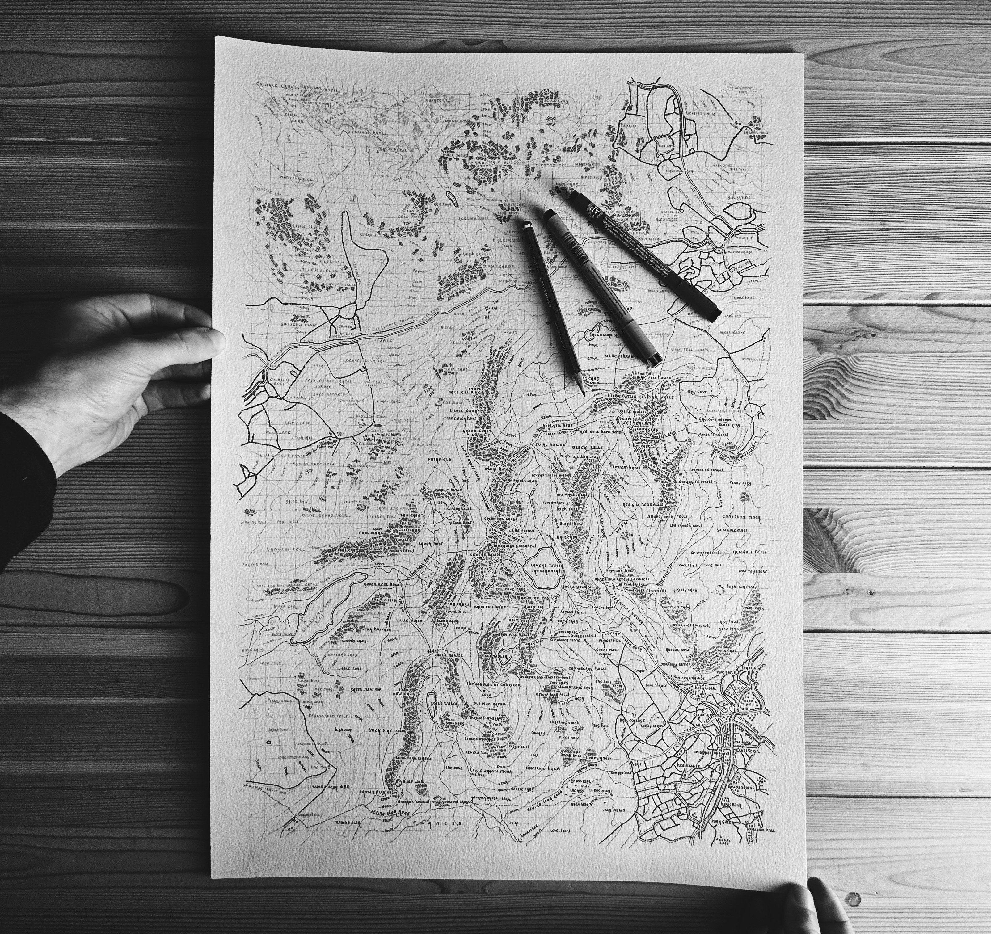
The Coniston Fells
-
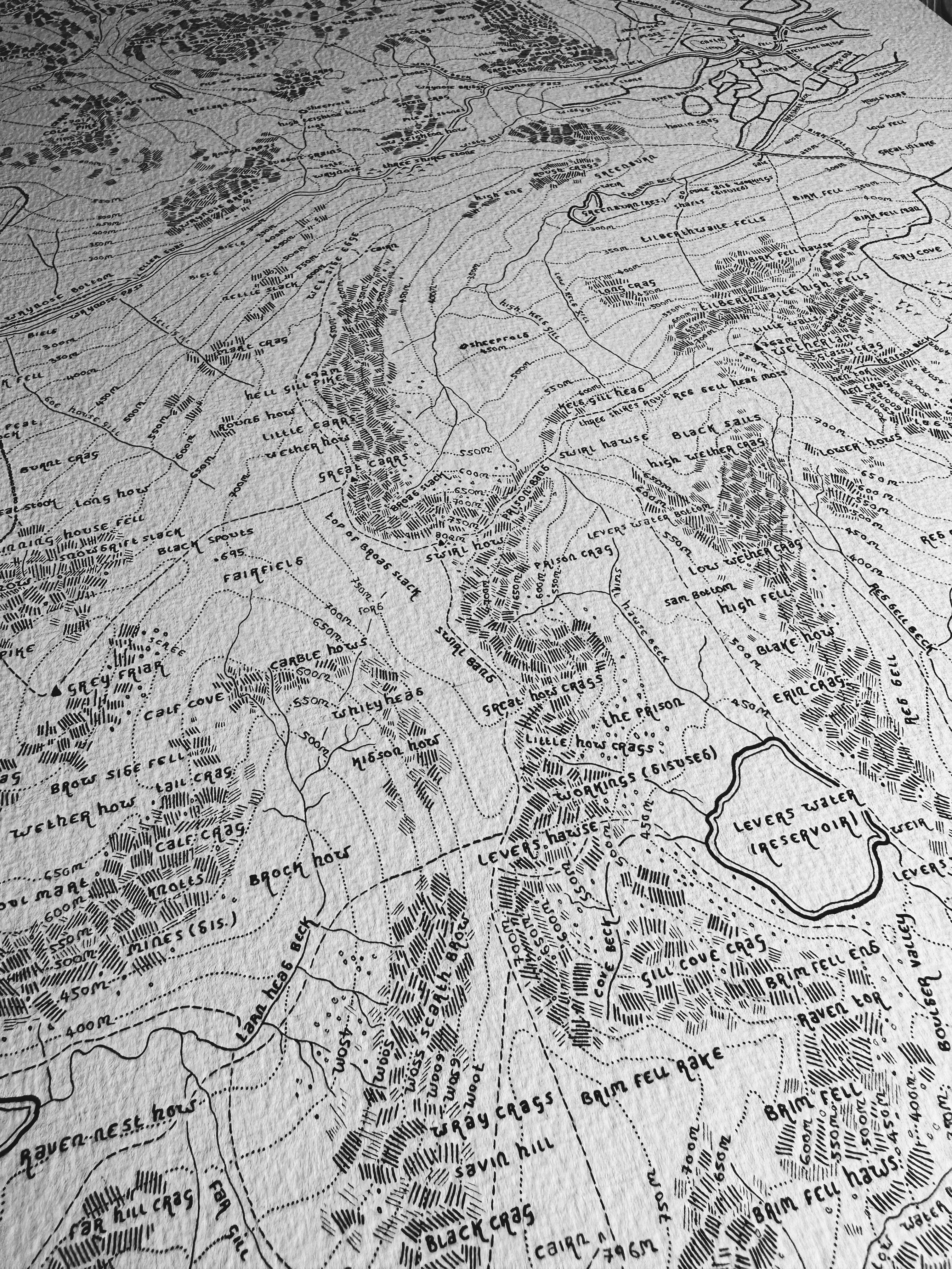
Includes a comprehensive list of place names, crags, mountains, and waterways.
-

Contour intervals are shown throughout the area covered, and are set at 50m.
-
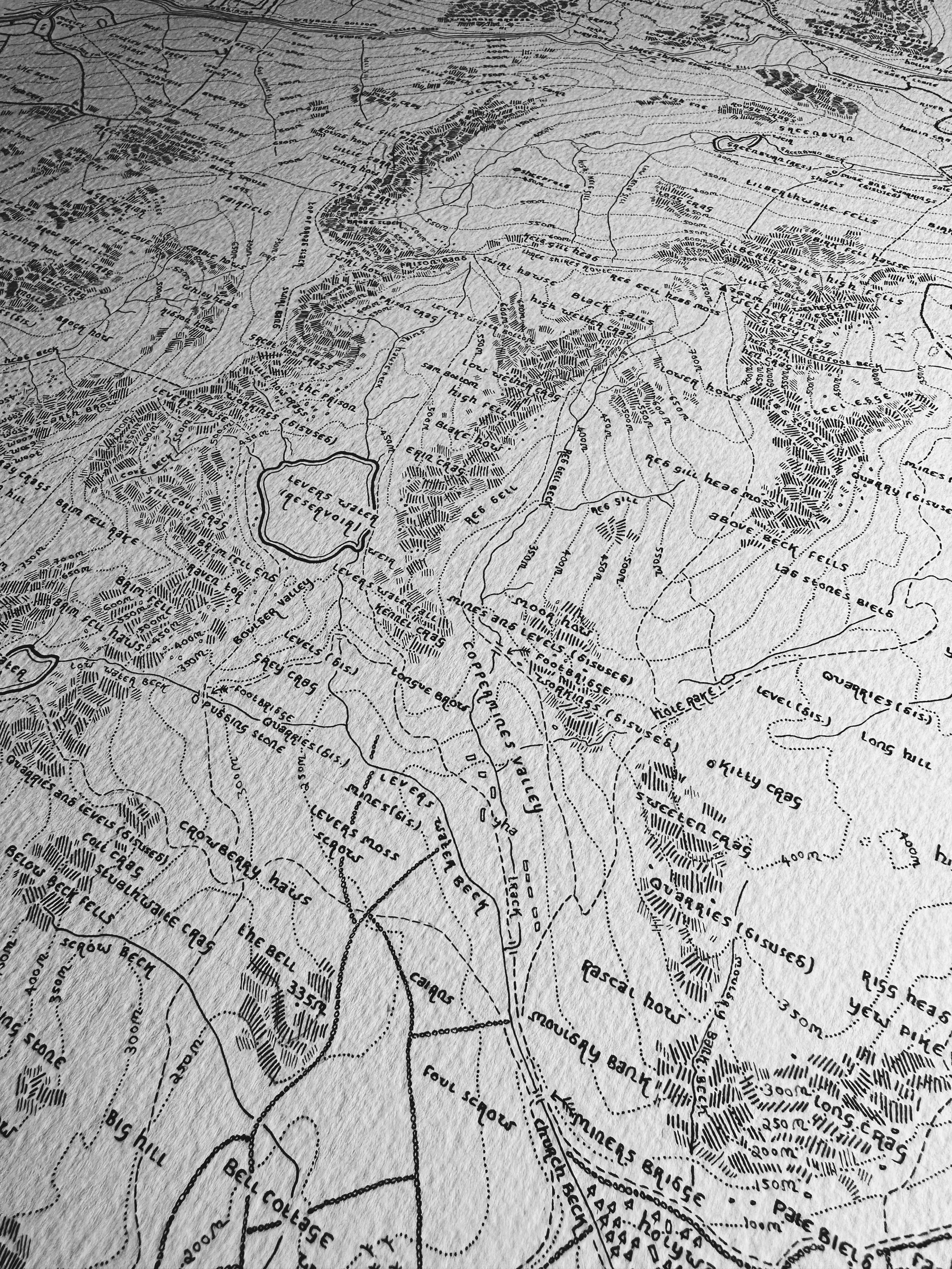
Displays stone wall placements, roads, and public rights of way.


